
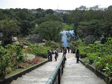
i know, i know, this blog is all about manila, but i can't help myself share with you this beautiful scene. Photo: mount makulot in batangas
Fast facts:
Batangas is a province of the Philippines located on the southwestern part of Luzon in the CALABARZON region. Its capital is Batangas City and it is bordered by the provinces of Cavite and Laguna to the north and Quezon to the east. Across the Verde Island Passages to the south is the island of Mindoro and to the west lies the South China Sea.
Mount Makulot - is a mountain located in north-west of Cuenca, Batangas, Philippines. This mountain is a tourist attraction to the municipality. Sometimes, the mountain is called Mt. Maculot. The Mountain is about 600 m (2,000 ft) tall and it is also located next to Taal Lake. Mount Makulot, a 600-meter (2,000 feet) high volcanic rock wall, is said to be part of Taal Volcano’s crater rim. Some scientists contend that Taal Volcano was once a massive volcano before a violent eruption caused the slopes to cave in. This caused water to rush in, forming a lake that left only the tip of the previous peak exposed, and that is now known as the current Volcano Island. The slopes of the previous volcano now formed ridges surrounding the lake, with Mount Makulot as the highest volcanic cone on the south side.


5 comments:
bat kaya makulot tawag? hehe
lovely shot mamuah!
Ang sarap naman dyan! Ang lakas ng alon. Mapuntahan nga minsan pag makatakas. hehe
Blog Hopping Nice One. Visit my sites at http://perspektib.blogspot.com, http://marlonofmanila.blogspot.com (photography)
Naakyat na namin tong Mt Maculot!
Danda danda!!!
Meowh!
ganda tlga batangas like mga fav place ko balete, agoncillo, balayan
Post a Comment