
 The Philippine relief map is located at the east side of Rizal Park / Luneta, seen along Taft Avenue. This relief map is the biggest and i could say is a very accurate copy of the archipelago, even the mountains and volcanoes are properly depicted here. Note: The smaller photo is taken from Google Earth.


7 comments:
Wow, that's amazing. The photography is very nice too.
Sorry again for having been a bit absent, but my week was too busy...
Lovely pictures! Your perspectives are great also and was quite interesting remembering Mendiola!
Thanks for the comments at Blogtrotter
Enjoy a great weekend!
Gil
That is really impressive!
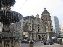
Nice one! Madalas ka ata sa Luneta. Sino ka date mo?
Baka naman pwede mo kodakan ang aking alma mater De La Salle University (Main Campus). Miss ko na eh. Try sneaking inside din. Kunwari mag inquire ka sa graduate studies chuchu. Para ma picture-an mo ang aking old haunts :D
joy
Your Love Coach
The Goddess In You
Norwich Daily Photo
Again, shame on me... never saw that.
Interesting.
waw, may tubig siya ngayon hehe. last time i went there, it was dried up.
partly inspired by your shots, I mapped the luneta map in openstreetmap.org
link here:
http://www.openstreetmap.org/?lat=14.58496&lon=120.9828&zoom=17&layers=0B00FTF
Post a Comment